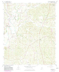
1967 Map of Hubbertville
USGS Topo · Published 1983About this map
The Sipsey River carves a winding path through the northern Fayette and Walker County line, anchoring a landscape defined by small rural settlements and family-named landmarks. During the mid-1960s, this area centered around Hubbertville and Glen Allen, where the topography transitions from the river bottomlands to the heights of Ford Mountain. The map reveals a high density of country churches and family burial grounds, such as Tidwell Chapel and Whitehead Cem, which served as the primary social and genealogical nodes for these upland communities.
Find a feature on this map
45 named features on this map. Tap any name to fly to it.
Don’t see what you’re looking for? This feature index may not catch every label — zoom into the map to look around manually.
Map Details
Editions of this 1967 Hubbertville Map
2 editions found
Other maps of this area

1953 · Birmingham
USGS Topo · 1:250,000

1956 · Birmingham
USGS Topo · 1:250,000

1957 · Birmingham
USGS Topo · 1:250,000

1967 · Bankston
USGS Topo · 1:24,000

1967 · Winfield SE
USGS Topo · 1:24,000
1967 · Carbon Hill
USGS Topo · 1:24,000

1967 · Hubbertville
USGS Topo · 1:24,000
1967 · Glen Allen
USGS Topo · 1:24,000
1967 · Berry
USGS Topo · 1:24,000

1967 · Fayette
USGS Topo · 1:24,000