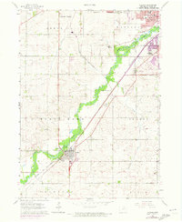
1963 Map of Hudson
USGS Topo · Published 1973About this map
Black Hawk Creek flows through the heart of this Iowa landscape, anchoring the settlement of Hudson and the southern reaches of Waterloo. The map captures a moment of mid-century growth, indicated by photorevisions that trace urban expansion toward the Cedar Falls Corporate Bdy and Waterloo Corporate Bdy. Transportation and utility infrastructure are prominent, with the Chicago and North Western railway threading through the valley and a Pipeline cutting across the agricultural sections of Orange and Lincoln townships.
Find a feature on this map
28 named features on this map. Tap any name to fly to it.
Don’t see what you’re looking for? This feature index may not catch every label — zoom into the map to look around manually.
Map Details
Editions of this 1963 Hudson Map
2 editions found
Other maps of this area

1954 · Waterloo
USGS Topo · 1:250,000

1955 · Waterloo
USGS Topo · 1:250,000

1963 · Buckingham
USGS Topo · 1:24,000

1963 · Hudson
USGS Topo · 1:24,000

1963 · Waterloo South
USGS Topo · 1:24,000

1963 · Eagle Center
USGS Topo · 1:24,000

1963 · Cedar Falls
USGS Topo · 1:24,000

1963 · Waterloo North
USGS Topo · 1:24,000

1971 · Zaneta
USGS Topo · 1:24,000

1971 · Reinbeck
USGS Topo · 1:24,000