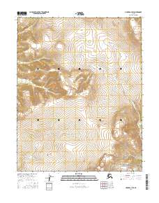
2016 Map of Hughes A-2 SW
USGS Topo · Published 2016About this map
Indian Mountains dominate the northeastern reaches of this landscape, rising above a network of waterways that define the Yukon-Koyukuk region. The area is characterized by a significant drainage system, with the Indian River carving a path through the central and eastern sections. Tributaries such as Raven Cr in the northwest, Black Cr in the center, and Pocahontas Cr in the southwest illustrate the complex hydrologic pattern of this remote terrain. The map provides a detailed view of the township and range divisions, including t8n r23e, t8n r24e, t7n r23e, and t7n r24e, which frame the undeveloped wilderness as it was documented in the early twenty-first century.
Find a feature on this map
9 named features on this map. Tap any name to fly to it.
Don’t see what you’re looking for? This feature index may not catch every label — zoom into the map to look around manually.
Map Details
Editions of this 2016 Hughes A-2 SW Map
This is the sole edition of this map. No revisions or reprints were ever made.
Other maps of this area

1951 · Hughes
USGS Topo · 1:250,000

1951 · Melozitna
USGS Topo · 1:250,000

1952 · Melozitna D-3
USGS Topo · 1:63,360

1954 · Melozitna D-3
USGS Topo · 1:63,360

1955 · Melozitna D-2
USGS Topo · 1:63,360

1955 · Hughes A-2
USGS Topo · 1:63,360

1955 · Hughes A-3
USGS Topo · 1:63,360

1956 · Hughes
USGS Topo · 1:250,000

1956 · Melozitna
USGS Topo · 1:250,000
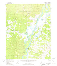
1956 · Hughes A-3
USGS Topo · 1:63,360