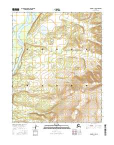
2016 Map of Hughes A-3 SE
USGS Topo · Published 2016About this map
Koyukuk River bends sharply through this interior Alaska landscape, defining the western edge of the settlement at Hughes. The community's spatial organization is revealed through its local infrastructure, including Hughes Lagoon Access Road and Hillside Road. To the north, the terrain transitions into a lake-studded lowland where Klalbaimunket Lake and Huntington Cr are prominent features.
Find a feature on this map
14 named features on this map. Tap any name to fly to it.
Don’t see what you’re looking for? This feature index may not catch every label — zoom into the map to look around manually.
Map Details
Editions of this 2016 Hughes A-3 SE Map
This is the sole edition of this map. No revisions or reprints were ever made.
Other maps of this area

1951 · Hughes
USGS Topo · 1:250,000

1951 · Melozitna
USGS Topo · 1:250,000

1952 · Melozitna D-3
USGS Topo · 1:63,360

1954 · Melozitna D-3
USGS Topo · 1:63,360

1955 · Melozitna D-2
USGS Topo · 1:63,360

1955 · Hughes A-2
USGS Topo · 1:63,360

1955 · Hughes A-3
USGS Topo · 1:63,360

1956 · Hughes
USGS Topo · 1:250,000

1956 · Melozitna
USGS Topo · 1:250,000
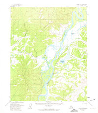
1956 · Hughes A-3
USGS Topo · 1:63,360