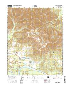
2016 Map of Hughes A-6 SW
USGS Topo · Published 2016About this map
The Koyukuk River meanders through the southern portion of this region, creating a complex system of oxbows and riverine features including Treat Island. This 2016 survey documents the vast elevation changes between the river valley and the rising slopes of the Zane Hills to the north. The drainage patterns are defined by several smaller tributaries, such as High Cr, which carve through the high terrain. The map provides a precise record of the Public Land Survey System grid across T8N R14E and T7N R14E, showing the intersection of waterway geography and administrative land divisions in a largely roadless interior landscape.
Find a feature on this map
8 named features on this map. Tap any name to fly to it.
Don’t see what you’re looking for? This feature index may not catch every label — zoom into the map to look around manually.
Map Details
Editions of this 2016 Hughes A-6 SW Map
This is the sole edition of this map. No revisions or reprints were ever made.
Other maps of this area

1951 · Shungnak
USGS Topo · 1:250,000

1951 · Kateel River
USGS Topo · 1:250,000

1951 · Hughes
USGS Topo · 1:250,000

1951 · Melozitna
USGS Topo · 1:250,000

1954 · Kateel River D-1
USGS Topo · 1:63,360

1954 · Melozitna D-6
USGS Topo · 1:63,360

1955 · Shungnak
USGS Topo · 1:250,000

1955 · Kateel River
USGS Topo · 1:250,000

1956 · Hughes
USGS Topo · 1:250,000

1956 · Melozitna
USGS Topo · 1:250,000