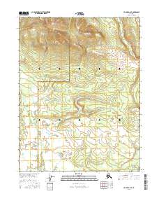
2016 Map of Hughes D-3 SE
USGS Topo · Published 2016About this map
The Hogatza River meanders through the eastern portion of this remote Alaskan landscape, defining the hydrology of a region where the Northwest Arctic Borough Yukon-Koyukuk Census Area boundary creates a formal division across the wilderness. The terrain is characterized by significant elevational shifts, with the Northwestern Arctic Borough occupying the high ground in the north while the Yukon-Koyukuk Census Area encompasses the river valley and southern lowlands. Surveyed sections including t17n r21e, t17n r22e, t16n r21e, and t16n r22e establish the Public Land Survey System grid over this largely uninhabited territory, providing a precise framework for understanding the transition from upland ridges to the riparian corridor of the Hogatza.
Find a feature on this map
6 named features on this map. Tap any name to fly to it.
Don’t see what you’re looking for? This feature index may not catch every label — zoom into the map to look around manually.
Map Details
Editions of this 2016 Hughes D-3 SE Map
This is the sole edition of this map. No revisions or reprints were ever made.
Other maps of this area

1951 · Hughes
USGS Topo · 1:250,000

1956 · Hughes
USGS Topo · 1:250,000

1964 · Hughes
USGS Topo · 1:250,000

1965 · Hughes
USGS Topo · 1:250,000
1986 · Hughes C-3
USGS Topo · 1:63,360
1986 · Hughes D-3
USGS Topo · 1:63,360
1986 · Hughes D-2
USGS Topo · 1:63,360
1986 · Hughes C-2
USGS Topo · 1:63,360
2016 · Hughes D-3 SW
USGS Topo · 1:25,000
2016 · Hughes C-2 NW
USGS Topo · 1:25,000