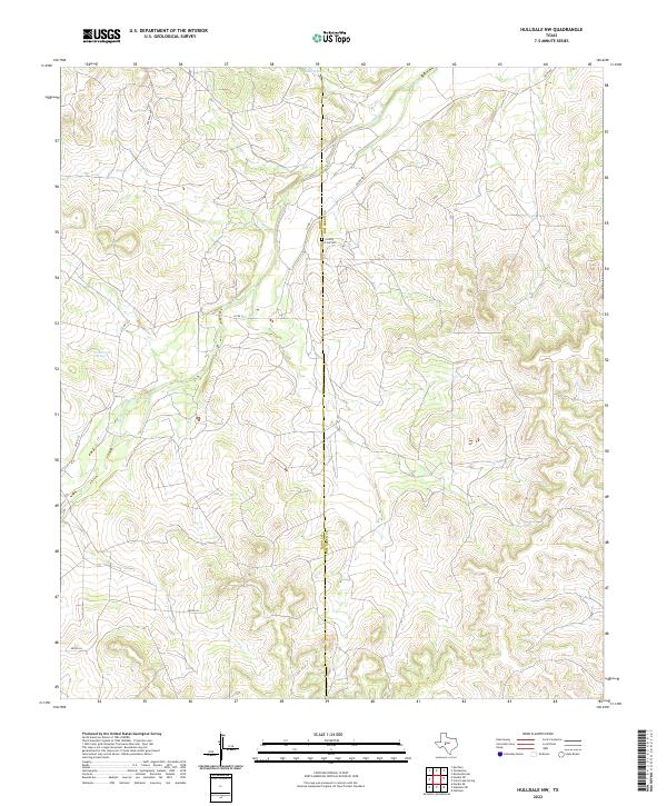
2022 Map of Hulldale NW
USGS Topo · Published 2022About this map
The Irion Co Tom Green Co boundary line divides this West Texas landscape, a region defined by high-elevation plateaus and the drainage systems of the Concho River basin. Historically focused on ranching and more recently on energy development, the area's geography is anchored by water sources like Byler Spring and Dobe Creek Springs. These springs feed into intermittent watercourses such as Dove Cr and Burks Cr, which have shaped the movement of people and livestock across these upland pastures for generations.
Find a feature on this map
10 named features on this map. Tap any name to fly to it.
Don’t see what you’re looking for? This feature index may not catch every label — zoom into the map to look around manually.
Map Details
Editions of this 2022 Hulldale NW Map
This is the sole edition of this map. No revisions or reprints were ever made.
Other maps of this area

1895 · Sherwood
USGS Topo · 1:125,000

1924 · Sherwood 1-d
USGS Topo · 1:48,000

1928 · Tankersly
USGS Topo · 1:62,500

1954 · San Angelo
USGS Topo · 1:250,000

1957 · Knickerbocker
USGS Topo · 1:62,500

1958 · San Angelo
USGS Topo · 1:250,000

1965 · San Angelo
USGS Topo · 1:250,000
1972 · Hulldale NW
USGS Topo · 1:24,000
1972 · Cold Creek Spring
USGS Topo · 1:24,000
1972 · Noelke NE
USGS Topo · 1:24,000