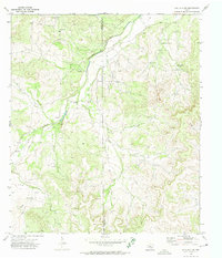
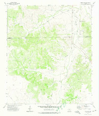
1972 Map of Hulldale NW
USGS Topo · Published 1974About this map
The high plateau and drainage basins of the Edwards Plateau are defined by the winding course of Dove Creek as it crosses the boundary between Irion and Tom Green counties. This 1972 survey illustrates an economy centered on resource extraction and ranching, with numerous Oil Wells and a Pumping Sta scattered across the upland breaks. The reliance on groundwater in this arid West Texas landscape is evident through the naming of specific infrastructure like the Headquarters Windmill, Steel Windmill, and Little Windmill.
Find a feature on this map
19 named features on this map. Tap any name to fly to it.
Don’t see what you’re looking for? This feature index may not catch every label — zoom into the map to look around manually.
Map Details
Editions of this 1972 Hulldale NW Map
2 editions found
Other maps of this area

1895 · Sherwood
USGS Topo · 1:125,000

1924 · Sherwood 1-d
USGS Topo · 1:48,000

1928 · Tankersly
USGS Topo · 1:62,500

1954 · San Angelo
USGS Topo · 1:250,000

1957 · Knickerbocker
USGS Topo · 1:62,500

1958 · San Angelo
USGS Topo · 1:250,000

1965 · San Angelo
USGS Topo · 1:250,000
1972 · Cold Creek Spring
USGS Topo · 1:24,000
1972 · Noelke NE
USGS Topo · 1:24,000
1972 · Noelke SE
USGS Topo · 1:24,000