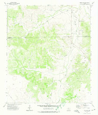
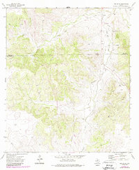
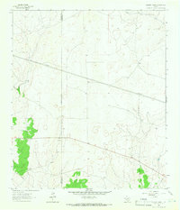
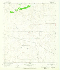
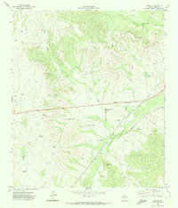
1972 Map of Noelke SE
USGS Topo · Published 1974About this map
Dove Creek and its tributary Dove Creek Draw carve through the plateau of the Edwards Plateau region, marking a landscape defined by ranching and resource extraction in the early 1970s. The terrain is sparsely settled, with the tiny outpost of Clark and an extensive network of Oil Wells and Gas Wells scattered across the limestone hills. A notable local landmark, Bootleggers Lane, hints at the region's cultural history, winding through the draws and ridges. Along the northern edge, the boundary for Irion Co Schleicher Co divides the landscape, while numerous pipelines and gravel pits underscore the industrial activity supporting the local economy during this era. This survey provides a clear view of the ranch-to-market infrastructure and the scattered petroleum developments that characterized West Texas at this time.
Find a feature on this map
10 named features on this map. Tap any name to fly to it.
Don’t see what you’re looking for? This feature index may not catch every label — zoom into the map to look around manually.
Map Details
Editions of this 1972 Noelke SE Map
2 editions found
Other maps of this area
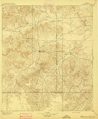
1895 · Sherwood
USGS Topo · 1:125,000

1954 · Sonora
USGS Topo · 1:250,000

1954 · San Angelo
USGS Topo · 1:250,000

1958 · Sonora
USGS Topo · 1:250,000

1958 · San Angelo
USGS Topo · 1:250,000
1964 · Eldorado NW
USGS Topo · 1:24,000
1964 · Oglesby Ranch
USGS Topo · 1:24,000
1964 · Moore Ranch
USGS Topo · 1:24,000

1965 · San Angelo
USGS Topo · 1:250,000
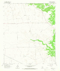
1971 · Noelke
USGS Topo · 1:24,000