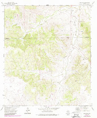
1972 Map of Noelke SE
USGS Topo · Published 1987About this map
Irion and Schleicher County lines bisect this West Texas landscape, defined by the dry watercourses of Dove Creek and Dove Creek Draw. The area represents a specialized industrial corridor during the early 1970s, as evidenced by a dense network of Oil Wells, Gas Wells, and a system of buried Pipelines that traverse the high plateaus. The topography is characterized by intricate contouring that reveals a series of branching draws and ridges, with local nomenclature like Bootleggers Lane hinting at the historical movement through these isolated hills. Beyond the energy extraction sites, a Gravel Pit serves as a marker of local material sourcing in an otherwise sparse and rugged terrain. Updates in the late 1980s illustrate the continued development of this resource-rich sector of the Edwards Plateau.
Find a feature on this map
9 named features on this map. Tap any name to fly to it.
Don’t see what you’re looking for? This feature index may not catch every label — zoom into the map to look around manually.
Map Details
Editions of this 1972 Noelke SE Map
2 editions found
Other maps of this area

1895 · Sherwood
USGS Topo · 1:125,000

1954 · Sonora
USGS Topo · 1:250,000

1954 · San Angelo
USGS Topo · 1:250,000

1958 · Sonora
USGS Topo · 1:250,000

1958 · San Angelo
USGS Topo · 1:250,000

1964 · Eldorado NW
USGS Topo · 1:24,000

1964 · Oglesby Ranch
USGS Topo · 1:24,000

1964 · Moore Ranch
USGS Topo · 1:24,000

1965 · San Angelo
USGS Topo · 1:250,000

1971 · Noelke
USGS Topo · 1:24,000