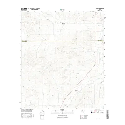
2016 Map of Hulldale
USGS Topo · Published 2016About this map
Hulldale and the surrounding ranchlands sit at the northern edge of the Edwards Plateau, where the local economy and landscape are shaped by the vital headwaters of the S Concho River. This 2016 survey illustrates a region defined by its water management, featuring named sources such as Hackberry Waterhole and Tenmile Waterhole that provide essential resources in an otherwise semi-arid environment. The topography is marked by significant rises like Big Hill, while the drainage network of Bois D'Arc Draw and South Concho Draw dictates the flow of the land toward the river system.
Find a feature on this map
16 named features on this map. Tap any name to fly to it.
Don’t see what you’re looking for? This feature index may not catch every label — zoom into the map to look around manually.
Map Details
Editions of this 2016 Hulldale Map
This is the sole edition of this map. No revisions or reprints were ever made.
Other maps of this area

1892 · San Angelo
USGS Topo · 1:125,000

1893 · Fort McKavett
USGS Topo · 1:125,000

1895 · Sherwood
USGS Topo · 1:125,000

1954 · Sonora
USGS Topo · 1:250,000

1954 · San Angelo
USGS Topo · 1:250,000

1958 · Sonora
USGS Topo · 1:250,000

1958 · San Angelo
USGS Topo · 1:250,000

1963 · Adams NW
USGS Topo · 1:24,000

1964 · Eldorado NW
USGS Topo · 1:24,000
1964 · Eldorado NE
USGS Topo · 1:24,000