
1969 Map of Humble City NE
USGS Topo · Published 1972About this map
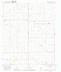
Texpac Oil Field dominates the southern landscape of this 1969 survey, where the borderlands of Texas and New Mexico meet. The terrain is defined by the ephemeral drainage patterns of Wards Draw and Wardswell Draw, which cut through a high plains environment dotted with dozens of individual wells and pipelines. This period reflects the intensive petroleum and mineral exploration of the Llano Estacado, evidenced by numerous drill holes and scattered Gravel Pit operations.
Find a feature on this map
11 named features on this map. Tap any name to fly to it.
Don’t see what you’re looking for? This feature index may not catch every label — zoom into the map to look around manually.
Map Details
Editions of this 1969 Humble City NE Map
4 editions found
Other maps of this area

1954 · Hobbs
USGS Topo · 1:250,000

1954 · Brownfield
USGS Topo · 1:250,000

1958 · Brownfield
USGS Topo · 1:250,000

1958 · Hobbs
USGS Topo · 1:250,000

1962 · Brownfield
USGS Topo · 1:250,000

1969 · Humble City
USGS Topo · 1:24,000

1969 · Humble City SE
USGS Topo · 1:24,000

1970 · Prairieview
USGS Topo · 1:24,000

1970 · Prairieview SE
USGS Topo · 1:24,000

1970 · Humble City SE
USGS Topo · 1:24,000