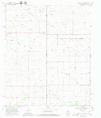
1969 Map of Humble City NE
USGS Topo · Published 1980About this map
Wards Draw cuts a prominent path through this arid landscape on the Texas-New Mexico border, where the industrial infrastructure of the Permian Basin dominates the terrain. This 1969 survey, revised with 1977 aerial photography, documents the expansion of the Texpac Oil Field across the southern portion of the quadrangle. The map is a study in specialized land use, where dozens of well sites and a dense network of pipelines overlay a rural grid marked by infrequent settlements like Waits Ranch. The presence of an Airport (Abandoned) and a Substa suggests changing transportation and utility needs during the mid-20th century. Local industry is further evidenced by a Gravel Pit and numerous drill holes, illustrating a region defined by extraction and resource management rather than residential growth.
Find a feature on this map
10 named features on this map. Tap any name to fly to it.
Don’t see what you’re looking for? This feature index may not catch every label — zoom into the map to look around manually.
Map Details
Editions of this 1969 Humble City NE Map
4 editions found
Other maps of this area

1954 · Hobbs
USGS Topo · 1:250,000

1954 · Brownfield
USGS Topo · 1:250,000

1958 · Brownfield
USGS Topo · 1:250,000

1958 · Hobbs
USGS Topo · 1:250,000

1962 · Brownfield
USGS Topo · 1:250,000

1969 · Humble City
USGS Topo · 1:24,000

1969 · Humble City NE
USGS Topo · 1:24,000

1969 · Humble City SE
USGS Topo · 1:24,000

1970 · Prairieview
USGS Topo · 1:24,000

1970 · Prairieview SE
USGS Topo · 1:24,000