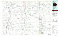
1984 Map of Humboldt
USGS Topo · Published 1985About this map
The Des Moines River winds through this North Central Iowa landscape, serving as a corridor for small riverside communities like Humboldt and Dakota City. The area is characterized by an extensive network of drainage infrastructure, such as Ditch No 62 and Ditch No 116, which supports the agricultural productivity of the surrounding plains. These human-made waterways intersect with natural features like Cylinder Creek and Beaver Creek, creating a complex hydrological system that spans multiple county lines including Pocahontas and Humboldt counties.
Find a feature on this map
117 named features on this map. Tap any name to fly to it.
Don’t see what you’re looking for? This feature index may not catch every label — zoom into the map to look around manually.
Map Details
Editions of this 1984 Humboldt Map
2 editions found
Other maps of this area

1923 · Lehigh
USGS Topo · 1:62,500

1923 · Fort Dodge
USGS Topo · 1:62,500

1954 · Fairmont
USGS Topo · 1:250,000

1954 · Mason City
USGS Topo · 1:250,000

1954 · Waterloo
USGS Topo · 1:250,000

1954 · Fort Dodge
USGS Topo · 1:250,000

1955 · Waterloo
USGS Topo · 1:250,000

1957 · Fort Dodge
USGS Topo · 1:250,000

1957 · Mason City
USGS Topo · 1:250,000

1958 · Mason City
USGS Topo · 1:250,000