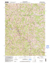
1998 Map of Hundred
USGS Topo · Published 2000About this map
The town of Hundred serves as the central hub of this northern West Virginia landscape, situated where the Virginia Line meets a complex network of waterways like Rockcamp Run and Church Fork. The map documents a rural society deeply rooted in its hollows, defined by family names and community anchors such as Thomas Chapel, Sancho Ch, and Old Harmony Ch. This 1998 inspection reveals a landscape of transition, noting an Air Strip (Abandoned) and the persistent presence of small crossroads settlements like Burton and Cottontown. The intricate drainage patterns, including Shriver Run and Bissett Run, dictate the winding paths of roads and the placement of early infrastructure like the Rush Run Sch. Spanning the border between Wetzel and Monongalia counties, the map serves as a detailed record of late-20th-century Appalachian geography before further modernization altered these valley corridors.
Find a feature on this map
79 named features on this map. Tap any name to fly to it.
Don’t see what you’re looking for? This feature index may not catch every label — zoom into the map to look around manually.
Map Details
Editions of this 1998 Hundred Map
This is the sole edition of this map. No revisions or reprints were ever made.
Other maps of this area

1903 · Littleton
USGS Topo · 1:62,500

1904 · Cameron
USGS Topo · 1:62,500

1905 · Mannington
USGS Topo · 1:62,500

1905 · Rogersville
USGS Topo · 1:62,500

1905 · Littleton
USGS Topo · 1:62,500

1923 · Mannington
USGS Topo · 1:62,500

1924 · Littleton
USGS Topo · 1:62,500

1926 · Littleton
USGS Topo · 1:62,500

1926 · Mannington
USGS Topo · 1:62,500

1935 · Cameron
USGS Topo · 1:62,500