
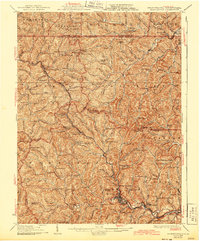
1926 Map of Mannington
USGS Topo · Published 1926About this map
The hills of Marion and Monongalia counties define this landscape, where the town of Mannington serves as a primary hub for a network of rural settlements. Surveyed in the early 1900s with culture updated in the 1920s, the map illustrates a transition between the coal-heavy river valleys and the upland farming communities. Notable landmarks like the Little Red Church and Blackshire Chapel are recorded alongside dozens of small schoolhouses, including Hennen School and Pawpaw School, which anchored these remote hollows.
Find a feature on this map
173 named features on this map. Tap any name to fly to it.
Don’t see what you’re looking for? This feature index may not catch every label — zoom into the map to look around manually.
Map Details
Editions of this 1926 Mannington Map
2 editions found
Other maps of this area

1901 · Waynesburg
USGS Topo · 1:62,500

1902 · Clarksburg
USGS Topo · 1:62,500

1902 · Fairmont
USGS Topo · 1:62,500

1903 · Littleton
USGS Topo · 1:62,500

1904 · Blacksville
USGS Topo · 1:62,500

1904 · Waynesburg
USGS Topo · 1:62,500

1904 · Cameron
USGS Topo · 1:62,500

1905 · Mannington
USGS Topo · 1:62,500

1905 · Rogersville
USGS Topo · 1:62,500

1905 · Centerpoint
USGS Topo · 1:62,500