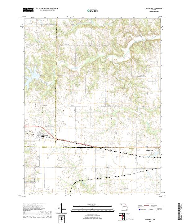
2021 Map of Hunnewell
USGS Topo · Published 2021About this map
Hunnewell sits at a historic intersection of rail and road where the borders of Shelby, Marion, and Monroe counties converge. This landscape is defined by the winding tributaries of the South Fork North River, including Pee Dee Cr and Sherry Br, which carve through the terrain north of the primary settlements. The survey reveals a rural infrastructure reliant on an extensive network of county roads, such as Co RD 214 and Co RD 390, which connect outlying farms to the local hubs of activity.
Find a feature on this map
64 named features on this map. Tap any name to fly to it.
Don’t see what you’re looking for? This feature index may not catch every label — zoom into the map to look around manually.
Map Details
Editions of this 2021 Hunnewell Map
This is the sole edition of this map. No revisions or reprints were ever made.
Other maps of this area

1903 · Palmyra
USGS Topo · 1:125,000

1948 · Quincy
USGS Topo · 1:250,000

1949 · Philadelphia
USGS Topo · 1:24,000

1950 · Philadelphia
USGS Topo · 1:24,000

1956 · Quincy
USGS Topo · 1:250,000

1959 · Monroe City
USGS Topo · 1:24,000

1959 · Lakenan
USGS Topo · 1:24,000

1959 · Joanna
USGS Topo · 1:24,000

1959 · Hunnewell
USGS Topo · 1:24,000
1960 · Goss
USGS Topo · 1:24,000