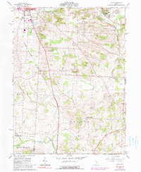
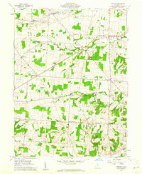
1961 Map of Hunt
USGS Topo · Published 1990About this map
Kenyon College dominates the northeastern landscape of this quadrangle, perched above the Kokosing River in the village of Gambier. The 1961 data, updated with 1974 photo-revisions, reveals a transitional era for central Ohio transportation and education. To the west, the edge of Mt Vernon features mid-century infrastructure like a Drive-in Theater and the Wynkoop Airport, while the rural townships of Clinton, Pleasant, and Morgan remain primarily agricultural. The presence of the Baltimore and Ohio and Penn Central railroads underscores the historical importance of rail corridors in connecting these small settlements.
Find a feature on this map
33 named features on this map. Tap any name to fly to it.
Don’t see what you’re looking for? This feature index may not catch every label — zoom into the map to look around manually.
Map Details
Editions of this 1961 Hunt Map
4 editions found
Other maps of this area

1908 · Granville
USGS Topo · 1:62,500

1909 · Newark
USGS Topo · 1:62,500

1910 · Granville
USGS Topo · 1:62,500

1912 · Gambier
USGS Topo · 1:62,500

1914 · Gambier
USGS Topo · 1:62,500

1915 · Fredericktown
USGS Topo · 1:62,500

1943 · Gambier
USGS Topo · 1:62,500

1943 · Fredericktown
USGS Topo · 1:62,500

1950 · Marion
USGS Topo · 1:250,000
1961 · Fredonia
USGS Topo · 1:24,000