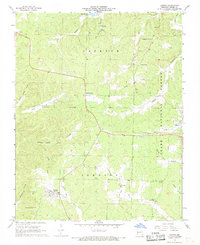
1968 Map of Hunter
USGS Topo · Published 1969About this map
Hunter and Ellsinore serve as the primary anchors of this late-1960s survey within the Clark National Forest. The landscape is defined by the transition from timbered ridges to the drainage of the Little Black River and Tenmile Creek. Industrial history is etched into the terrain along Copper Mine Hollow, where an Old Railroad Grade and the Copper Mine itself point to an era of extraction. Scattered throughout the hollows are smaller family and community landmarks like Crites Corner and White Mill Cem. The presence of the Hunter Lookout Tower underscores the region's managed forest character, while several rural sanctuaries such as Mt Carmel Ch and the Evangelistic Center Ch reflect the enduring social fabric of these Missouri Ozark townships.
Find a feature on this map
36 named features on this map. Tap any name to fly to it.
Don’t see what you’re looking for? This feature index may not catch every label — zoom into the map to look around manually.
Map Details
Editions of this 1968 Hunter Map
2 editions found
Other maps of this area

1932 · Piedmont
USGS Topo · 1:62,500

1934 · Williamsville
USGS Topo · 1:48,000

1935 · Piedmont
USGS Topo · 1:62,500

1940 · Williamsville
USGS Topo · 1:62,500

1943 · Ellington
USGS Topo · 1:62,500

1944 · Grandin
USGS Topo · 1:62,500

1945 · Ellington
USGS Topo · 1:62,500

1946 · Grandin
USGS Topo · 1:62,500

1949 · Rolla
USGS Topo · 1:250,000

1953 · Rolla
USGS Topo · 1:250,000