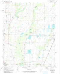
1971 Map of Hunter West
USGS Topo · Published 1993About this map
Cotton Plant anchors the southern portion of this Arkansas Delta landscape, where the Southwestern St Louis railroad corridor cuts a diagonal path toward the settlement of Hunter. The terrain is defined by the slow-moving waters of De View Bayou and its accompanying chain of oxbows and cypress breaks, including Upper Seibert Lake, Johnson Lake, and Polly Ann Lake. This watery geography dictated the early placement of rural clusters like Howell and Beeton along the elevated ground of Nubbin Ridge.
Find a feature on this map
44 named features on this map. Tap any name to fly to it.
Don’t see what you’re looking for? This feature index may not catch every label — zoom into the map to look around manually.
Map Details
Editions of this 1971 Hunter West Map
3 editions found
Other maps of this area

1935 · Gregory
USGS Topo · 1:62,500

1939 · Hunter
USGS Topo · 1:62,500

1940 · Brinkley
USGS Topo · 1:62,500

1941 · De Valls Bluff
USGS Topo · 1:62,500

1948 · Helena
USGS Topo · 1:250,000

1950 · Helena
USGS Topo · 1:250,000

1953 · Memphis
USGS Topo · 1:250,000

1955 · Helena
USGS Topo · 1:250,000

1956 · Memphis
USGS Topo · 1:250,000

1956 · Hunter
USGS Topo · 1:62,500