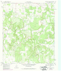
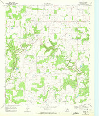
1969 Map of Hunting Shirt Creek
USGS Topo · Published 1987About this map
Hunting Shirt Creek and the Sabana River define the winding drainage patterns of this rural landscape spanning the border of Eastland and Comanche counties. Based on late 1960s field data with mid-1980s updates, the map reveals a countryside characterized by small family burial grounds and active energy extraction. Local history and genealogy researchers can locate the Center Point Cem, Brown Cem, and Jewel Cem tucked away between the creek bends. The infrastructure of the era is clearly visible through a network of pipelines and numerous Gas Wells and Oil Wells that dot the terrain, alongside a Pumping Sta and a Gravel Pit. The map captures the quiet transition of this Texas ranching and oil country before modern developments altered the rural road and property networks.
Find a feature on this map
15 named features on this map. Tap any name to fly to it.
Don’t see what you’re looking for? This feature index may not catch every label — zoom into the map to look around manually.
Map Details
Editions of this 1969 Hunting Shirt Creek Map
2 editions found
Other maps of this area

1894 · Eastland
USGS Topo · 1:125,000

1954 · Abilene
USGS Topo · 1:250,000

1958 · Abilene
USGS Topo · 1:250,000

1966 · Sipe Springs
USGS Topo · 1:24,000
1966 · Rising Star
USGS Topo · 1:24,000

1966 · Kokomo
USGS Topo · 1:24,000

1966 · Carbon
USGS Topo · 1:24,000

1966 · Cisco South
USGS Topo · 1:24,000
1968 · Gorman
USGS Topo · 1:24,000
1969 · Duster
USGS Topo · 1:24,000