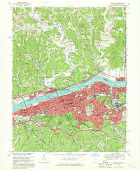
1968 Map of Huntington
USGS Topo · Published 1970About this map
The Ohio River serves as a massive industrial and transit corridor here, separating the dense urban grid of Huntington and West Huntington from the riverfront communities of Chesapeake and Proctorville in Ohio. The riverfront is a complex network of infrastructure, featuring extensive rail yards for the Chesapeake and Ohio and Baltimore and Ohio railroads. Large institutional campuses like Huntington State Hospital and St Marys Hospital anchor the city center, while Ritter Park and the Spring Hill Cemetery provide significant open spaces within the corporate boundaries.
Find a feature on this map
81 named features on this map. Tap any name to fly to it.
Don’t see what you’re looking for? This feature index may not catch every label — zoom into the map to look around manually.
Map Details
Editions of this 1968 Huntington Map
4 editions found
Other maps of this area

1892 · Huntington
USGS Topo · 1:125,000

1898 · Huntington
USGS Topo · 1:125,000

1898 · Ironton
USGS Topo · 1:62,500

1900 · Ironton
USGS Topo · 1:62,500

1901 · Guyandot
USGS Topo · 1:62,500

1901 · Ceredo
USGS Topo · 1:62,500

1902 · Guyandot
USGS Topo · 1:62,500

1903 · Kenova
USGS Topo · 1:125,000

1904 · Kenova
USGS Topo · 1:125,000

1906 · Athalia
USGS Topo · 1:62,500