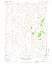
1958 Map of Huntsman Ranch
USGS Topo · Published 1967About this map
Huntsman Ranch serves as a lone primary settlement anchor in this high-desert landscape, situated near Spring Creek. The terrain is dominated by the dramatic elevation changes of the Adobe Range, which rises sharply to the east. This 1950s era survey illustrates a specialized water economy, where survival and livestock operations relied on named water sources like Lower Dry Susie Spring, Hot Springs, and the seasonal flows of Dry Gulch and Susie Creek.
Find a feature on this map
14 named features on this map. Tap any name to fly to it.
Don’t see what you’re looking for? This feature index may not catch every label — zoom into the map to look around manually.
Map Details
Editions of this 1958 Huntsman Ranch Map
3 editions found
Other maps of this area

1952 · Dixie Flats
USGS Topo · 1:62,500

1952 · Carlin
USGS Topo · 1:62,500

1955 · Winnemucca
USGS Topo · 1:250,000

1955 · Elko
USGS Topo · 1:250,000

1958 · Winnemucca
USGS Topo · 1:250,000

1958 · Elko
USGS Topo · 1:250,000

1958 · Hunter
USGS Topo · 1:24,000

1958 · Huntsman Ranch
USGS Topo · 1:24,000

1958 · Doby Summit
USGS Topo · 1:24,000
1958 · Swales Mountain
USGS Topo · 1:24,000