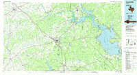
1985 Map of Huntsville
USGS Topo · Published 1985About this map
The State Prison Farm and the sprawling campus of Sam Houston State University anchor the landscape of Walker County in the mid-1980s. This planimetric survey captures a region defined by its managed timberlands and significant water bodies, including the vast expanse of Lake Livingston to the east and the northern reaches of Lake Conroe to the south. The Missouri Pacific RR corridor bisects the terrain, connecting established timber and agricultural hubs like Phelps, New Waverly, and Riverside. Smaller, rural communities such as Old Waverly and Roans Prairie are visible alongside family-named landmarks like Rhodes Cem and Bath Cem. Large tracts of the Sam Houston National Forest dominate the southern half of the map, illustrating the enduring relationship between the local economy and the piney woods of East Texas.
Find a feature on this map
184 named features on this map. Tap any name to fly to it.
Don’t see what you’re looking for? This feature index may not catch every label — zoom into the map to look around manually.
Map Details
Editions of this 1985 Huntsville Map
2 editions found
Other maps of this area

1914 · Navasota
USGS Topo · 1:62,500

1931 · Iola
USGS Topo · 1:62,500

1943 · Liberty
USGS Topo · 1:125,000

1953 · Palestine
USGS Topo · 1:250,000

1954 · Waco
USGS Topo · 1:250,000

1954 · Beaumont
USGS Topo · 1:250,000

1954 · Austin
USGS Topo · 1:250,000

1955 · Waco
USGS Topo · 1:250,000

1955 · Rayburn
USGS Topo · 1:62,500

1955 · New Willard
USGS Topo · 1:62,500