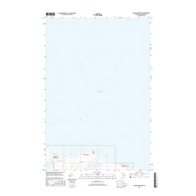
2017 Map of Huron Mountain
USGS Topo · Published 2017About this map
Lake Superior dominates the northern expanse of this coastal study, where the shoreline of Marquette County meets the waters of Conway Bay. The terrain is defined by the elevation of Huron Mountain, which stands near the mouth of the Pine River. This specific geography creates a series of coastal inland waters, including the sequestered Pine Lake and Conway Lake, both tucked behind the prominent landforms of Pine River Point and Conway Point. The infrastructure is sparse, restricted primarily to the Huron Mountain Club Rd and W Conway Rd, reflecting the secluded and private character of this shoreline. The map provides a detailed view of the natural hydrology and land divisions, showing the interface between the lake and the rugged peninsula during the early twenty-first century.
Find a feature on this map
12 named features on this map. Tap any name to fly to it.
Don’t see what you’re looking for? This feature index may not catch every label — zoom into the map to look around manually.
Map Details
Editions of this 2017 Huron Mountain Map
This is the sole edition of this map. No revisions or reprints were ever made.
Other maps of this area

1954 · Huron Mountain
USGS Topo · 1:62,500

1954 · Big Bay
USGS Topo · 1:62,500

1958 · Hancock
USGS Topo · 1:250,000

1958 · Marquette
USGS Topo · 1:250,000

1960 · Hancock
USGS Topo · 1:250,000

1960 · Marquette
USGS Topo · 1:250,000

1961 · Marquette
USGS Topo · 1:250,000

1961 · Hancock
USGS Topo · 1:250,000

1966 · Hancock
USGS Topo · 1:250,000

1968 · Marquette
USGS Topo · 1:250,000