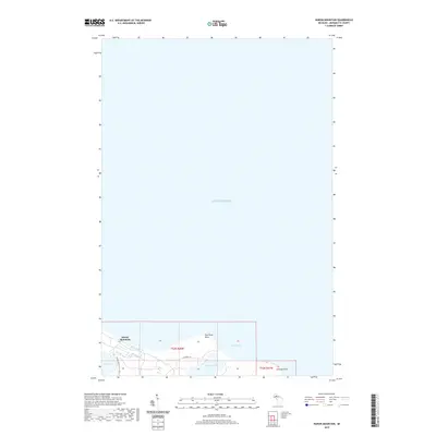
2019 Map of Huron Mountain
USGS Topo · Published 2019About this map
Lake Superior dominates this northern Marquette County coastline, where the rugged topography of Huron Mountain meets the water. The landscape is defined by its coastal hydrology, featuring Pine Lake and Conway Lake tucked behind the shoreline at Pine River Point and Conway Point. The Pine River flows through this area, connecting the interior water bodies to the expansive Conway Bay. Transportation in this largely secluded region is limited to local routes such as Huron Mountain Club Rd and W Conway Rd, reflecting the area's history as a private retreat and wilderness preserve. This survey captures the transition from the high elevations of the Huron Mountains down to the natural harbors and points that characterize the Upper Peninsula's southern Superior shore.
Find a feature on this map
12 named features on this map. Tap any name to fly to it.
Don’t see what you’re looking for? This feature index may not catch every label — zoom into the map to look around manually.
Map Details
Editions of this 2019 Huron Mountain Map
This is the sole edition of this map. No revisions or reprints were ever made.
Other maps of this area

1954 · Huron Mountain
USGS Topo · 1:62,500

1954 · Big Bay
USGS Topo · 1:62,500

1958 · Hancock
USGS Topo · 1:250,000

1958 · Marquette
USGS Topo · 1:250,000

1960 · Hancock
USGS Topo · 1:250,000

1960 · Marquette
USGS Topo · 1:250,000

1961 · Marquette
USGS Topo · 1:250,000

1961 · Hancock
USGS Topo · 1:250,000

1966 · Hancock
USGS Topo · 1:250,000

1968 · Marquette
USGS Topo · 1:250,000