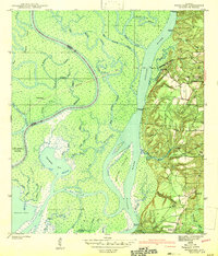
1943 Map of Hurricane
USGS Topo · Published 1943About this map
The Tensaw River and Mobile River dominate this 1940s landscape, where the alluvial delta of Baldwin County meets a complex web of bayous and islands. The village of Hurricane sits at the edge of the wetlands, served by the Louisville and Nashville Railroad and the adjacent Ortiz Siding. Along the eastern bluffs, the terrain rises sharply toward Stony Hill, providing a firm site for community life at St Marys Ch and Hurricane Sch.
Find a feature on this map
57 named features on this map. Tap any name to fly to it.
Don’t see what you’re looking for? This feature index may not catch every label — zoom into the map to look around manually.
Map Details
Editions of this 1943 Hurricane Map
2 editions found
Other maps of this area

1921 · Fairhope
USGS Topo · 1:62,500

1922 · Mobile
USGS Topo · 1:62,500

1940 · Mobile
USGS Topo · 1:31,680

1940 · Mobile
USGS Topo · 1:62,500

1941 · Chickasaw
USGS Topo · 1:31,680

1941 · Blakeley
USGS Topo · 1:31,680

1941 · Bay Minette
USGS Topo · 1:62,500

1941 · Creola
USGS Topo · 1:62,500

1941 · Fairhope
USGS Topo · 1:62,500

1942 · Hurricane
USGS Topo · 1:31,680