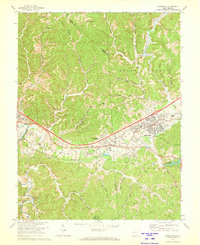
1972 Map of Hurricane
USGS Topo · Published 1973About this map
Culloden and Hurricane anchor this 1970s landscape, illustrating the development of the Teays Valley region. The infrastructure of the era is clearly defined by the Chesapeake and Ohio railroad line and the emergence of residential clusters near the Mud River. Local social history is preserved through the locations of numerous houses of worship, such as Bedford Chapel, Mount Zion Ch, and Susanna Ch, alongside many family and community burial grounds including Culloden Cem and Valley View Cem.
Find a feature on this map
51 named features on this map. Tap any name to fly to it.
Don’t see what you’re looking for? This feature index may not catch every label — zoom into the map to look around manually.
Map Details
Editions of this 1972 Hurricane Map
2 editions found
Other maps of this area

1892 · Huntington
USGS Topo · 1:125,000

1898 · Huntington
USGS Topo · 1:125,000

1899 · Charleston
USGS Topo · 1:125,000

1902 · Milton
USGS Topo · 1:62,500

1906 · Glenwood
USGS Topo · 1:62,500

1906 · Winfield
USGS Topo · 1:62,500

1908 · Glenwood
USGS Topo · 1:62,500

1908 · Winfield
USGS Topo · 1:62,500

1909 · Saint Albans
USGS Topo · 1:62,500

1931 · Saint Albans
USGS Topo · 1:62,500