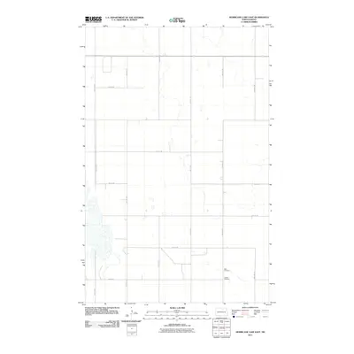
2011 Map of Hurricane Lake East
USGS Topo · Published 2011About this map
Towner County's prairie landscape is defined by a rigorous section-line road grid and scattered wetlands in this early 21st-century study. The southeastern corner contains essential sites for family historians, including Wahi Cemetery and Ostreim Cemetery, which stand as quiet landmarks in an area dominated by large-scale agricultural tracts. These sites are linked by local thoroughfares such as 59th Ave Ne and 68th St Ne. The map reveals the intricate hydrology of the region, where numerous unnamed sloughs and seasonal water bodies break the regularity of the cultivated fields. Major corridors like 73rd St Ne and 54th Ave Ne provide the primary framework for this rural North Dakota township, illustrating a persistence of the original homestead surveying patterns into the modern era.
Find a feature on this map
13 named features on this map. Tap any name to fly to it.
Don’t see what you’re looking for? This feature index may not catch every label — zoom into the map to look around manually.
Map Details
Editions of this 2011 Hurricane Lake East Map
This is the sole edition of this map. No revisions or reprints were ever made.
Other maps of this area

1953 · Devils Lake
USGS Topo · 1:250,000

1956 · Devils Lake
USGS Topo · 1:250,000

1971 · Bisbee South
USGS Topo · 1:24,000

1971 · Considine
USGS Topo · 1:24,000

1971 · Leeds NE
USGS Topo · 1:24,000

1971 · Hurricane Lake West
USGS Topo · 1:24,000

1971 · York
USGS Topo · 1:24,000

1971 · Leeds
USGS Topo · 1:24,000

1971 · Mylo SE
USGS Topo · 1:24,000
1971 · Hurricane Lake East
USGS Topo · 1:24,000