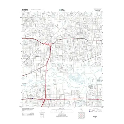
2012 Map of Hurst
USGS Topo · Published 2012About this map
The W Fork Trinity River snakes through this portion of Tarrant County, anchoring a landscape where established communities and modern infrastructure converge. Richland Hills and the older settlements of Smithfield and Ederville are shown amidst a dense network of suburban development and arterial roads. The map provides significant genealogical value through its marking of several local burial grounds, including the Arwine Cem and Tomlin Cem, which stand as reminders of the area's earlier agricultural roots. The industrial and transportation character of the region is evident in the presence of Fuller Airport and the complex interchanges of the NE Loop 820 and Airport Fwy. This 2012 survey captures the transition between the urban corridor and the riparian zones of Big Fossil Cr and Village Creek.
Find a feature on this map
30 named features on this map. Tap any name to fly to it.
Don’t see what you’re looking for? This feature index may not catch every label — zoom into the map to look around manually.
Map Details
Editions of this 2012 Hurst Map
This is the sole edition of this map. No revisions or reprints were ever made.
Other maps of this area

1894 · Fort Worth
USGS Topo · 1:125,000

1931 · Grapevine
USGS Topo · 1:62,500

1954 · Dallas
USGS Topo · 1:250,000

1955 · Haltom City
USGS Topo · 1:24,000

1955 · Keller
USGS Topo · 1:24,000

1955 · Fort Worth
USGS Topo · 1:24,000

1955 · Haltom City
USGS Topo · 1:62,500

1958 · Dallas
USGS Topo · 1:250,000

1959 · Kennedale
USGS Topo · 1:24,000

1959 · Arlington
USGS Topo · 1:24,000