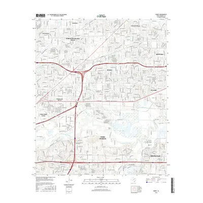
2016 Map of Hurst
USGS Topo · Published 2016About this map
Hurst and its neighboring Mid-Cities communities are centered in this topographic study, which documents the dense suburban development of Northeast Tarrant County. The landscape is defined by the winding course of the West Fork Trinity River, which forms a significant greenbelt through the southern half of the map. This river corridor, featuring landmarks like Village Creek Lake and Millbrook Addition Reservoir, provides a natural contrast to the grid of neighborhoods in North Richland Hills, Bedford, and Euless.
Find a feature on this map
349 named features on this map. Tap any name to fly to it.
Don’t see what you’re looking for? This feature index may not catch every label — zoom into the map to look around manually.
Map Details
Editions of this 2016 Hurst Map
This is the sole edition of this map. No revisions or reprints were ever made.
Other maps of this area

1894 · Fort Worth
USGS Topo · 1:125,000

1931 · Grapevine
USGS Topo · 1:62,500

1954 · Dallas
USGS Topo · 1:250,000

1955 · Haltom City
USGS Topo · 1:24,000

1955 · Keller
USGS Topo · 1:24,000

1955 · Fort Worth
USGS Topo · 1:24,000

1955 · Haltom City
USGS Topo · 1:62,500

1958 · Dallas
USGS Topo · 1:250,000

1959 · Kennedale
USGS Topo · 1:24,000

1959 · Arlington
USGS Topo · 1:24,000