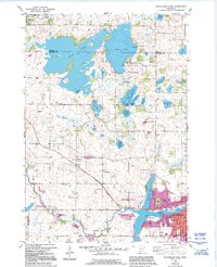
1982 Map of Hutchinson West
USGS Topo · Published 1995About this map
Cedar Lake and Belle Lake dominate the northern landscape of this region, which was meticulously updated in the early 1990s to reflect evolving conservation and land-use patterns. The expansion of the Hutchinson State Wildlife Mgmt Area and the Prieve State Wildlife Mgmt Area underscores a shift toward environmental preservation along the South Fork Crow River.
Find a feature on this map
53 named features on this map. Tap any name to fly to it.
Don’t see what you’re looking for? This feature index may not catch every label — zoom into the map to look around manually.
Map Details
Editions of this 1982 Hutchinson West Map
2 editions found
Other maps of this area

1953 · New Ulm
USGS Topo · 1:250,000

1953 · Saint Cloud
USGS Topo · 1:250,000

1957 · Saint Cloud
USGS Topo · 1:250,000

1957 · New Ulm
USGS Topo · 1:250,000

1958 · New Ulm
USGS Topo · 1:250,000

1958 · Saint Cloud
USGS Topo · 1:250,000

1958 · Dassel
USGS Topo · 1:62,500

1958 · Hutchinson
USGS Topo · 1:62,500

1967 · New Ulm
USGS Topo · 1:250,000

1967 · Litchfield South
USGS Topo · 1:24,000