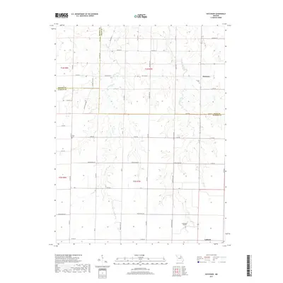
2017 Map of Hutchison
USGS Topo · Published 2017About this map
The intersection of Monroe, Ralls, and Audrain counties defines the rural geography of this northeastern Missouri landscape. The terrain is shaped by the dendritic drainage patterns of West Lick Creek, Middle Lick Cr, and East Lick Creek, which carve gentle valleys through the agricultural plains. To the south, the city of Laddonia serves as a primary hub, while the smaller settlement of Hutchison sits further north along the county line.
Find a feature on this map
56 named features on this map. Tap any name to fly to it.
Don’t see what you’re looking for? This feature index may not catch every label — zoom into the map to look around manually.
Map Details
Editions of this 2017 Hutchison Map
This is the sole edition of this map. No revisions or reprints were ever made.
Other maps of this area

1890 · Mexico
USGS Topo · 1:125,000

1932 · Mexico
USGS Topo · 1:62,500

1942 · Wellsville
USGS Topo · 1:62,500

1945 · Florida
USGS Topo · 1:62,500

1945 · Perry
USGS Topo · 1:62,500

1948 · Quincy
USGS Topo · 1:250,000

1956 · Quincy
USGS Topo · 1:250,000
1972 · Mexico East
USGS Topo · 1:24,000
1972 · Santa Fe
USGS Topo · 1:24,000
1972 · Florida
USGS Topo · 1:24,000