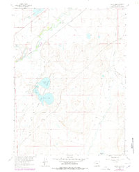
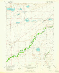
1963 Map of Hutton Lake
USGS Topo · Published 1978About this map
Hutton Lake National Wildlife Refuge anchors this high-plains landscape, protecting a cluster of water bodies including Creighton Lake, Rush Lake, and Hutton Lake itself. The map reveals a complex water-management system essential for ranching and wildlife in Albany County, where the Laramie River is diverted through the Pioneer Canal and various irrigation works like the Dowlin Ditch and Haley and Hoge Ditch.
Find a feature on this map
27 named features on this map. Tap any name to fly to it.
Don’t see what you’re looking for? This feature index may not catch every label — zoom into the map to look around manually.
Map Details
Editions of this 1963 Hutton Lake Map
2 editions found
Other maps of this area

1895 · Laramie
USGS Topo · 1:125,000

1902 · Laramie
USGS Topo · 1:125,000

1905 · Laramie
USGS Topo · 1:125,000

1906 · Laramie
USGS Topo · 1:125,000

1908 · Laramie
USGS Topo · 1:125,000

1954 · Cheyenne
USGS Topo · 1:250,000

1958 · Cheyenne
USGS Topo · 1:250,000
1962 · Miller
USGS Topo · 1:24,000
1963 · Laramie
USGS Topo · 1:24,000
1963 · Caldwell Lake
USGS Topo · 1:24,000