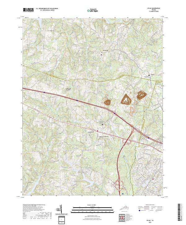
2022 Map of Hylas
USGS Topo · Published 2022About this map
Centerville and Rockville serve as central nodes in this landscape where Goochland, Hanover, and Henrico counties meet. The terrain is defined by the drainage basins of the South Anna River to the north and the extensive network of Tuckahoe Cr and its tributaries, including Little Tuckahoe Cr and Readers Br. This modern survey highlights the persistent rural-suburban character of the region, anchored by established community landmarks such as Saint Matthews Methodist Church/Cem and Berea Baptist Church Cem.
Find a feature on this map
170 named features on this map. Tap any name to fly to it.
Don’t see what you’re looking for? This feature index may not catch every label — zoom into the map to look around manually.
Map Details
Editions of this 2022 Hylas Map
This is the sole edition of this map. No revisions or reprints were ever made.
Other maps of this area

1890 · Goochland
USGS Topo · 1:125,000

1892 · Goochland
USGS Topo · 1:125,000

1936 · Richmond West
USGS Topo · 1:24,000

1936 · Glen Allen
USGS Topo · 1:24,000

1941 · Glen Allen
USGS Topo · 1:31,680

1942 · Westhampton
USGS Topo · 1:31,680

1943 · Mabelton
USGS Topo · 1:31,680

1943 · Fine Creek Mills
USGS Topo · 1:31,680
1943 · Hanover Academy
USGS Topo · 1:31,680

1943 · Perkinsville
USGS Topo · 1:31,680