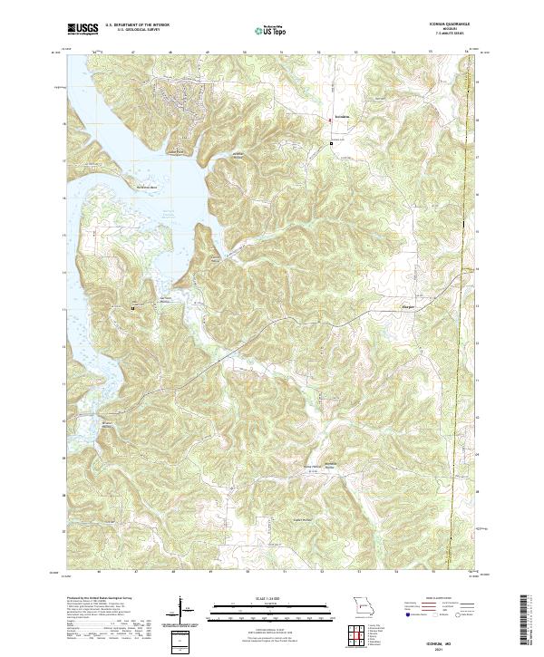
2021 Map of Iconium
USGS Topo · Published 2021About this map
Iconium and the surrounding Ozark foothills of St. Clair County are defined by the winding eastern reaches of the Harry S Truman Reservoir. This modern topographic study reveals the rugged shoreline where the reservoir meets the landscape at landmarks like Cedar Point and Horseshoe Bend. The interior terrain is deeply dissected by numerous named drainages, including Debeker Hollow, Collins Hollow, and Wisener Hollow, which feed into the reservoir basin.
Find a feature on this map
61 named features on this map. Tap any name to fly to it.
Don’t see what you’re looking for? This feature index may not catch every label — zoom into the map to look around manually.
Map Details
Editions of this 2021 Iconium Map
This is the sole edition of this map. No revisions or reprints were ever made.
Other maps of this area

1884 · Bolivar
USGS Topo · 1:125,000

1886 · Stockton
USGS Topo · 1:125,000

1887 · Clinton
USGS Topo · 1:125,000

1887 · Warsaw
USGS Topo · 1:125,000

1892 · Bolivar
USGS Topo · 1:125,000

1894 · Warsaw
USGS Topo · 1:125,000

1894 · Clinton
USGS Topo · 1:125,000

1938 · Vista
USGS Topo · 1:24,000

1939 · Osceola
USGS Topo · 1:24,000

1940 · Osceola
USGS Topo · 1:24,000