
1940 Map of Iconium
USGS Topo · Published 1963About this map
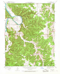
The Osage River meanders sharply through this 1940 survey, carving the distinctive Horseshoe Bend in the northwest. This rural landscape on the border of St. Clair, Benton, and Hickory counties is defined by a network of hollows—such as Blalock Hollow and Snyder Hollow—that drain into the Briley Creek and Hogles Creek watersheds. The settlement of Iconium serves as a local hub, while smaller communities like Corbin and Harper mark the intersections of early mid-century road networks.
Find a feature on this map
32 named features on this map. Tap any name to fly to it.
Don’t see what you’re looking for? This feature index may not catch every label — zoom into the map to look around manually.
Map Details
Editions of this 1940 Iconium Map
2 editions found
Other maps of this area

1884 · Bolivar
USGS Topo · 1:125,000

1886 · Stockton
USGS Topo · 1:125,000

1887 · Clinton
USGS Topo · 1:125,000

1887 · Warsaw
USGS Topo · 1:125,000

1892 · Bolivar
USGS Topo · 1:125,000

1894 · Warsaw
USGS Topo · 1:125,000

1894 · Clinton
USGS Topo · 1:125,000

1938 · Vista
USGS Topo · 1:24,000

1939 · Osceola
USGS Topo · 1:24,000

1940 · Osceola
USGS Topo · 1:24,000