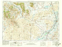
1955 Map of Idaho Falls
USGS Topo · Published 1983About this map
Craters of the Moon National Monument dominates the western landscape of this mid-century survey, its expansive lava fields contrasting sharply with the agricultural corridors along the Snake River. The region's mid-century character is defined by the massive Idaho National Engineering Laboratory site, a sprawling federal installation established in the high desert between Arco and Idaho Falls. This era of development is marked by the presence of Atomic City, a settlement tied to the burgeoning nuclear research industry of the 1950s.
Find a feature on this map
160 named features on this map. Tap any name to fly to it.
Don’t see what you’re looking for? This feature index may not catch every label — zoom into the map to look around manually.
Map Details
Editions of this 1955 Idaho Falls Map
5 editions found

Other maps of this area

1895 · Hailey
USGS Topo · 1:125,000

1897 · Hailey
USGS Topo · 1:125,000

1917 · Portneuf
USGS Topo · 1:62,500

1918 · Paradise Valley
USGS Topo · 1:62,500

1924 · Ammon
USGS Topo · 1:62,500

1929 · Bayhorse
USGS Topo · 1:125,000

1934 · American Falls
USGS Topo · 1:62,500

1934 · Michaud
USGS Topo · 1:62,500

1935 · MacKay
USGS Topo · 1:96,000

1935 · Borah Peak
USGS Topo · 1:125,000