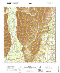
2019 Map of Iditarod A-1 SE
USGS Topo · Published 2019About this map
The Kuskokwim River dominates the western portion of this interior landscape, winding through a broad valley where the river’s braids and channels create a complex system of bars and islands. This 2019 survey captures the wilderness boundary where the Yukon-Koyukuk Census Area meets the Bethel Census Area. To the east of the river corridor, the terrain rises into series of ridges and hills defined by tight contour intervals, contrasting sharply with the flat, wetland-heavy lowlands of the river basin. The map illustrates a remote section of the Alaskan bush, primarily used for navigation and subsistence, devoid of permanent roads or settlements but rich in the natural topographical detail required for navigating the river’s shifting course.
Find a feature on this map
8 named features on this map. Tap any name to fly to it.
Don’t see what you’re looking for? This feature index may not catch every label — zoom into the map to look around manually.
Map Details
Editions of this 2019 Iditarod A-1 SE Map
This is the sole edition of this map. No revisions or reprints were ever made.
Other maps of this area

1949 · McGrath
USGS Topo · 1:250,000

1950 · Sleetmute
USGS Topo · 1:250,000

1950 · McGrath
USGS Topo · 1:250,000

1951 · Lime Hills
USGS Topo · 1:250,000

1951 · Iditarod
USGS Topo · 1:250,000

1954 · Sleetmute D-1
USGS Topo · 1:63,360

1954 · Iditarod A-1
USGS Topo · 1:63,360
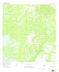
1954 · McGrath A-6
USGS Topo · 1:63,360
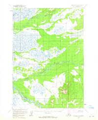
1954 · Lime Hills D-8
USGS Topo · 1:63,360

1954 · Sleetmute
USGS Topo · 1:250,000