
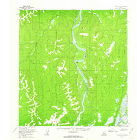
1954 Map of Iditarod A-1
USGS Topo · Published 1962About this map
The Kuskokwim River defines the landscape of this mid-century survey, carving a wide, meandering path through the interior of Alaska. This 1954 fieldwork reveals a region shaped by its watercourses, notably the Nunsatuk River and the sharp bend known as Devils Elbow. Human presence is sparse and temporary, evidenced only by the isolated Wasky Cabins and other unnamed Cabins situated along the riverbanks.
Find a feature on this map
8 named features on this map. Tap any name to fly to it.
Don’t see what you’re looking for? This feature index may not catch every label — zoom into the map to look around manually.
Map Details
Editions of this 1954 Iditarod A-1 Map
2 editions found
Other maps of this area

1949 · McGrath
USGS Topo · 1:250,000

1950 · Sleetmute
USGS Topo · 1:250,000

1950 · McGrath
USGS Topo · 1:250,000

1951 · Lime Hills
USGS Topo · 1:250,000

1951 · Iditarod
USGS Topo · 1:250,000

1954 · Sleetmute D-1
USGS Topo · 1:63,360

1954 · Sleetmute D-2
USGS Topo · 1:63,360

1954 · Iditarod B-1
USGS Topo · 1:63,360

1954 · McGrath B-6
USGS Topo · 1:63,360

1954 · Iditarod B-2
USGS Topo · 1:63,360