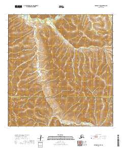
2019 Map of Iditarod A-2 SW
USGS Topo · Published 2019About this map
The Kuskokwim Mountains dominate this remote Alaskan interior landscape, characterized by complex topographic relief and a high concentration of wetlands. Flowing through the northern reaches of the quadrangle, the Little S Fork provides the primary drainage for the area's intricate network of valleys. This 2019 survey captures the border between the Yukon-Koyukuk Census Area and the Bethel Census Area, a boundary line that bisects the southern portion of the sheet. The absence of named settlements or roads underscores the wilderness character of the region, where the Public Land Survey System grids—including t23n r41w and t24n r42w—overlay a landscape of dense contours and riparian corridors.
Find a feature on this map
9 named features on this map. Tap any name to fly to it.
Don’t see what you’re looking for? This feature index may not catch every label — zoom into the map to look around manually.
Map Details
Editions of this 2019 Iditarod A-2 SW Map
This is the sole edition of this map. No revisions or reprints were ever made.
Other maps of this area

1950 · Sleetmute
USGS Topo · 1:250,000

1951 · Iditarod
USGS Topo · 1:250,000

1954 · Sleetmute D-3
USGS Topo · 1:63,360

1954 · Sleetmute D-2
USGS Topo · 1:63,360

1954 · Iditarod A-3
USGS Topo · 1:63,360

1954 · Iditarod A-2
USGS Topo · 1:63,360

1954 · Sleetmute
USGS Topo · 1:250,000

1956 · Iditarod
USGS Topo · 1:250,000
2019 · Sleetmute D-2 NW
USGS Topo · 1:25,000
2019 · Sleetmute D-3 NE
USGS Topo · 1:25,000