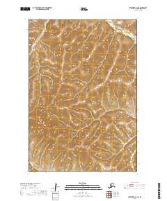
2019 Map of Sleetmute D-3 NE
USGS Topo · Published 2019About this map
Holokuk Cr carves through the southwestern corner of this interior Alaskan landscape, serving as the primary drainage for a region defined by its significant relief. The terrain is marked by a series of prominent ridges and high-elevation points that reach well above the 1,000-foot contour lines, creating a repetitive pattern of steep slopes and narrow valleys. This 2019 survey documents the intricate topography within the Public Land Survey System boundaries of t22n r42w, t22n r41w, t21n r42w, and t21n r41w. The lack of named settlements or infrastructure highlights the isolation of this portion of the Bethel Census Area, where the natural drainage of the creek and the high mountain elevations remain the defining geographic characteristics.
Find a feature on this map
5 named features on this map. Tap any name to fly to it.
Don’t see what you’re looking for? This feature index may not catch every label — zoom into the map to look around manually.
Map Details
Editions of this 2019 Sleetmute D-3 NE Map
This is the sole edition of this map. No revisions or reprints were ever made.
Other maps of this area

1950 · Sleetmute
USGS Topo · 1:250,000

1951 · Iditarod
USGS Topo · 1:250,000

1954 · Sleetmute D-3
USGS Topo · 1:63,360

1954 · Sleetmute D-2
USGS Topo · 1:63,360

1954 · Iditarod A-2
USGS Topo · 1:63,360

1954 · Sleetmute
USGS Topo · 1:250,000

1956 · Iditarod
USGS Topo · 1:250,000
2019 · Sleetmute D-2 NW
USGS Topo · 1:25,000
2019 · Sleetmute D-2 SW
USGS Topo · 1:25,000
2019 · Sleetmute D-3 SW
USGS Topo · 1:25,000