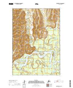
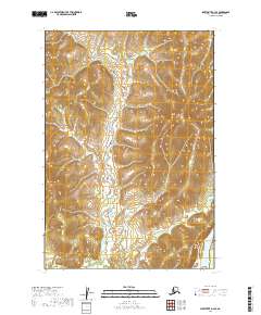
2019 Map of Sleetmute D-2 SW
USGS Topo · Published 2019About this map
Kuskokwim River and its complex network of waterways dominate this part of the Bethel Census Area, where the settlement of Stony River sits at the junction of major fluvial arteries. This 2019 survey captures the essential infrastructure of a modern Alaskan river community, including the Stony River 2 Airport and the local Birch Road. The landscape is characterized by the winding path of Moose Creek and the notable Stony River Cutoff, illustrating how the hydrology of the region dictates the layout of the town. The intricate braiding of the rivers against the terrain reveals the importance of seasonal water levels to the geography and connectivity of this interior Alaska location.
Find a feature on this map
14 named features on this map. Tap any name to fly to it.
Don’t see what you’re looking for? This feature index may not catch every label — zoom into the map to look around manually.
Map Details
Editions of this 2019 Sleetmute D-2 SW Map
This is the sole edition of this map. No revisions or reprints were ever made.
Other maps of this area

1950 · Sleetmute
USGS Topo · 1:250,000

1954 · Sleetmute D-3
USGS Topo · 1:63,360

1954 · Sleetmute C-2
USGS Topo · 1:63,360

1954 · Sleetmute D-2
USGS Topo · 1:63,360

1954 · Sleetmute C-3
USGS Topo · 1:63,360

1954 · Sleetmute
USGS Topo · 1:250,000
2019 · Sleetmute D-2 NW
USGS Topo · 1:25,000
2019 · Sleetmute C-3 NE
USGS Topo · 1:25,000
2019 · Sleetmute C-2 NE
USGS Topo · 1:25,000
2019 · Sleetmute D-3 SE
USGS Topo · 1:25,000