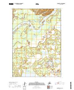
2019 Map of Sleetmute C-3 NE
USGS Topo · Published 2019About this map
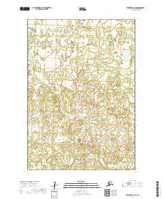
The Kuskokwim River carves a massive, winding path through this corner of the Bethel Census Area, creating a complex network of sloughs and side channels. The river dominates the landscape, illustrating the dynamic nature of Alaskan waterways as they shift through low-lying wetlands and alluvial plains. Along the northwestern edge, Inowak Cr feeds into this system, contributing to a terrain defined more by water and seasonal drainage than by permanent human infrastructure. The map provides a precise look at the township and range lines, including t19n r42w and t18n r41w, which delineate the vast, undeveloped tracts characteristic of this interior region. This is a landscape where the primary geography is defined by the fluid movement of the river and the countless ponds that dot the wilderness.
Find a feature on this map
6 named features on this map. Tap any name to fly to it.
Don’t see what you’re looking for? This feature index may not catch every label — zoom into the map to look around manually.
Map Details
Editions of this 2019 Sleetmute C-3 NE Map
This is the sole edition of this map. No revisions or reprints were ever made.
Other maps of this area

1950 · Sleetmute
USGS Topo · 1:250,000

1954 · Sleetmute D-3
USGS Topo · 1:63,360

1954 · Sleetmute C-2
USGS Topo · 1:63,360

1954 · Sleetmute D-2
USGS Topo · 1:63,360

1954 · Sleetmute C-3
USGS Topo · 1:63,360

1954 · Sleetmute
USGS Topo · 1:250,000
2019 · Sleetmute C-3 NW
USGS Topo · 1:25,000
2019 · Sleetmute D-2 SW
USGS Topo · 1:25,000
2019 · Sleetmute D-3 SW
USGS Topo · 1:25,000
2019 · Sleetmute C-2 SW
USGS Topo · 1:25,000