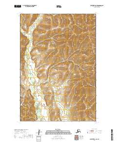
2019 Map of Sleetmute D-2 NW
USGS Topo · Published 2019About this map
The Kuskokwim Mountains dominate the interior landscape of the Bethel Census Area in this 2019 survey. The area is characterized by a series of north-to-south trending ridges and valleys, with elevations rising sharply above the drainage basins. Cutting through the western sections, the waters of Moose Cr navigate a complex network of wetlands and lower-lying terrain, illustrating the intricate hydrography typical of this region's wilderness. This map provides a detailed view of the terrain before the modern impacts of climate and geomorphology continue to shift these remote Alaskan waterways. Without any named settlements or roads present on the sheet, the map serves as a primary record of the untouched natural geography and the legal township and range boundaries that organize this part of the Alaskan interior.
Find a feature on this map
6 named features on this map. Tap any name to fly to it.
Don’t see what you’re looking for? This feature index may not catch every label — zoom into the map to look around manually.
Map Details
Editions of this 2019 Sleetmute D-2 NW Map
This is the sole edition of this map. No revisions or reprints were ever made.
Other maps of this area

1950 · Sleetmute
USGS Topo · 1:250,000

1951 · Iditarod
USGS Topo · 1:250,000

1954 · Sleetmute D-3
USGS Topo · 1:63,360

1954 · Sleetmute D-2
USGS Topo · 1:63,360

1954 · Iditarod A-2
USGS Topo · 1:63,360

1954 · Sleetmute
USGS Topo · 1:250,000

1956 · Iditarod
USGS Topo · 1:250,000
2019 · Sleetmute D-2 SW
USGS Topo · 1:25,000
2019 · Sleetmute D-3 SE
USGS Topo · 1:25,000
2019 · Sleetmute D-2 NE
USGS Topo · 1:25,000