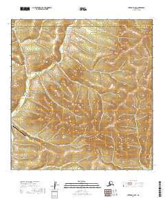
2019 Map of Iditarod A-5 SE
USGS Topo · Published 2019About this map
The Kuskokwim Mountains dominate this region of interior Alaska, where the drainage patterns of the Donlin Cr and Crooked Cr watersheds define the land. This 2019 survey documents a landscape primarily characterized by its remote hydrology and mineral-inflected topography, evidenced by series of named gulches including Quartz Gulch, Snow Gulch, and Ruby Gulch. The most significant human infrastructure in the area is the Donlin Creek Airport, providing essential aerial access to this otherwise roadless territory. The map also delineates the jurisdictional boundary between the Yukon-Koyukuk Census Area and the Bethel Census Area, which bisects the northern section of the quadrangle. Other notable water features include the southern flow of American Cr and the remote reaches of Anaconda Cr.
Find a feature on this map
21 named features on this map. Tap any name to fly to it.
Don’t see what you’re looking for? This feature index may not catch every label — zoom into the map to look around manually.
Map Details
Editions of this 2019 Iditarod A-5 SE Map
This is the sole edition of this map. No revisions or reprints were ever made.
Other maps of this area

1950 · Sleetmute
USGS Topo · 1:250,000

1951 · Iditarod
USGS Topo · 1:250,000

1954 · Sleetmute D-6
USGS Topo · 1:63,360
1954 · Sleetmute D-7
USGS Topo · 1:63,360

1954 · Iditarod A-5
USGS Topo · 1:63,360

1954 · Iditarod A-4
USGS Topo · 1:63,360

1954 · Sleetmute
USGS Topo · 1:250,000

1956 · Iditarod
USGS Topo · 1:250,000
2019 · Sleetmute D-7 NE
USGS Topo · 1:25,000
2019 · Sleetmute D-6 NW
USGS Topo · 1:25,000