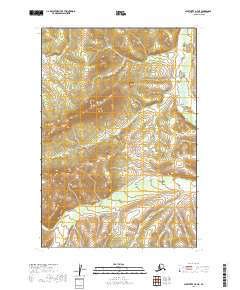
2019 Map of Sleetmute D-7 NE
USGS Topo · Published 2019About this map
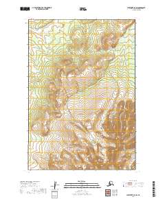
Juninguira Mtn dominates the central landscape of this wilderness area in the Bethel Census Area, rising as a prominent topographic anchor between shifting drainage systems. The map illustrates a complex network of waterways, with the headwaters and tributaries of Getmuna Cr and Crooked Cr carving through the terrain. These streams suggest the seasonal hydraulic patterns of the Alaska interior, where small water bodies like Eagle Cr define the local geography. The absence of roads or permanent structures reflects the primary character of this region as a remote natural corridor, shaped by elevation changes and the persistent flow of the Kuskokwim River watershed's upper reaches. Map readers can observe how the terrain transitions from the steep slopes of the mountain into broader, wetland-rich basins.
Find a feature on this map
8 named features on this map. Tap any name to fly to it.
Don’t see what you’re looking for? This feature index may not catch every label — zoom into the map to look around manually.
Map Details
Editions of this 2019 Sleetmute D-7 NE Map
This is the sole edition of this map. No revisions or reprints were ever made.
Other maps of this area

1950 · Sleetmute
USGS Topo · 1:250,000

1951 · Iditarod
USGS Topo · 1:250,000

1954 · Sleetmute D-6
USGS Topo · 1:63,360
1954 · Sleetmute D-7
USGS Topo · 1:63,360

1954 · Iditarod A-5
USGS Topo · 1:63,360

1954 · Sleetmute
USGS Topo · 1:250,000

1956 · Iditarod
USGS Topo · 1:250,000
2019 · Sleetmute D-7 NW
USGS Topo · 1:25,000
2019 · Sleetmute D-7 SE
USGS Topo · 1:25,000
2019 · Sleetmute D-7 SW
USGS Topo · 1:25,000