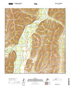
2019 Map of Iditarod B-1 SE
USGS Topo · Published 2019About this map
Kuskokwim River serves as the dominant geographical feature in this interior Alskan landscape, cutting a wide, meandering path through the central portion of the quadrangle. The river's braiding and island formations indicate a dynamic waterway within a largely uninhabited wilderness, bordered by the smaller Nunsatuk River entering from the west. This 2019 survey documents the river's alignment and the surrounding topography within the t26n r37w and t25n r37w townships. The absence of roads or permanent settlements underscores the remote character of this region within the Yukon-Koyukuk Census Area, where travel and life are historically tied to the flow of the major river systems.
Find a feature on this map
8 named features on this map. Tap any name to fly to it.
Don’t see what you’re looking for? This feature index may not catch every label — zoom into the map to look around manually.
Map Details
Editions of this 2019 Iditarod B-1 SE Map
This is the sole edition of this map. No revisions or reprints were ever made.
Other maps of this area

1949 · McGrath
USGS Topo · 1:250,000

1950 · McGrath
USGS Topo · 1:250,000

1951 · Iditarod
USGS Topo · 1:250,000

1954 · Iditarod B-1
USGS Topo · 1:63,360

1954 · Iditarod A-1
USGS Topo · 1:63,360

1954 · McGrath B-6
USGS Topo · 1:63,360
1954 · McGrath A-6
USGS Topo · 1:63,360

1956 · Iditarod
USGS Topo · 1:250,000

1958 · McGrath
USGS Topo · 1:250,000
2019 · McGrath A-6 NW
USGS Topo · 1:25,000