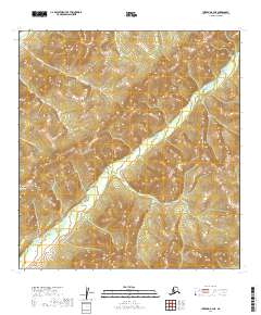
2019 Map of Iditarod B-4 NE
USGS Topo · Published 2019About this map
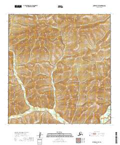
The Kuskokwim Mountains dominate this 2019 survey, defining a drainage system where numerous creeks carve through high-elevation terrain. The map's hydrography is concentrated around the primary artery of Bonanza Cr, which is fed by tributary waters from Ruby Cr and Murray Cr. Further north, the landscape is shaped by the headwaters of Otter Cr and Long Cr. This topographic study reveals a wilderness devoid of modern infrastructure or permanent settlements, preserving the pristine character of the Yukon-Koyukuk region. The dense contouring illustrates the complex ridgelines and steep valleys that define this portion of the Alaskan interior, offering a clear record of the area's natural geological formations and untouched watercourses.
Find a feature on this map
15 named features on this map. Tap any name to fly to it.
Don’t see what you’re looking for? This feature index may not catch every label — zoom into the map to look around manually.
Map Details
Editions of this 2019 Iditarod B-4 NE Map
This is the sole edition of this map. No revisions or reprints were ever made.
Other maps of this area

1951 · Iditarod
USGS Topo · 1:250,000

1954 · Iditarod C-4
USGS Topo · 1:63,360

1954 · Iditarod C-3
USGS Topo · 1:63,360

1954 · Iditarod B-3
USGS Topo · 1:63,360

1954 · Iditarod B-4
USGS Topo · 1:63,360

1956 · Iditarod
USGS Topo · 1:250,000
2019 · Iditarod B-4 SE
USGS Topo · 1:25,000
2019 · Iditarod B-4 NW
USGS Topo · 1:25,000
2019 · Iditarod B-4 SW
USGS Topo · 1:25,000
2019 · Iditarod B-3 SW
USGS Topo · 1:25,000