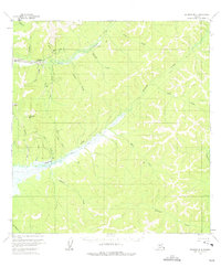
1954 Map of Iditarod B-4
USGS Topo · Published 1975About this map
Flat and Discovery anchor this mid-century look at the Iditarod mining district, where the landscape is defined by the extensive Placer Mine operations along the creek beds. Large sections of Tailings follow the path of Otter Creek, reflecting decades of industrial activity in this gold-bearing region. Transportation in the interior relied heavily on seasonal movement, evidenced by the distinct Summer Trail and Winter Trail networks that cross the drainage of Murray Creek and Long Creek. To the west, the Landing Strip at Flat provided a vital link to the outside world, while isolated Cabin locations are scattered throughout the drainages of Bonanza Creek and Prince Creek. The terrain is dominated by high ground like Chicken Mtn, separating the complex web of gold-producing streams that form the headwaters of the regional river systems.
Find a feature on this map
30 named features on this map. Tap any name to fly to it.
Don’t see what you’re looking for? This feature index may not catch every label — zoom into the map to look around manually.
Map Details
Editions of this 1954 Iditarod B-4 Map
2 editions found
Other maps of this area

1951 · Iditarod
USGS Topo · 1:250,000

1954 · Iditarod A-5
USGS Topo · 1:63,360

1954 · Iditarod C-4
USGS Topo · 1:63,360

1954 · Iditarod A-4
USGS Topo · 1:63,360

1954 · Iditarod B-5
USGS Topo · 1:63,360

1954 · Iditarod C-5
USGS Topo · 1:63,360

1954 · Iditarod A-3
USGS Topo · 1:63,360

1954 · Iditarod C-3
USGS Topo · 1:63,360

1954 · Iditarod B-3
USGS Topo · 1:63,360

1954 · Iditarod B-4
USGS Topo · 1:63,360